


Vizrt Viz Courious Maps 9.1: detalle de hasta 15 metros por píxel
En un tiempo en el que la noticia puede saltar en cualquier rincón del mundo, Vizrt actualiza Courious Map con nuevas aplicaciones e integración total con el servicio online de imágenes satelitales de Digital Globe.


El software de animación de mapas y vistas aéreas, Courious podrá verse de manos de Vizrt en IBC’09 en su versión 9.1. Los mapas Curious están considerados por muchos como un estándar de facto para la creación y animación de mapas electrónicos. Ran Yakir, director de I+D de Vizrt ha comentado que “en un momento en que las noticias pueden entrar en erupción en cualquier rincón del mundo, es necesario que los periodistas cuenten con un software de creación de mapas capaz de integrar imágenes satelitales de alta resolución. Curious 9.1 no tiene rival en su capacidad para construir, etiquetar, y animar todo tipo de mapas atractivos a todo color para que los organismos de radiodifusión pueden ilustrar de manera eficaz transmitiendo la ubicación geográfica de un determinado evento”.
Viz Curious Mapas 9.1 añade varias características esenciales que hacen que sea más fácil incorporar imágenes globales de alta resolución por satélite procedentes de varios proveedores. Uno de estos proveedores es DigitalGlobe, empresa que ofrece ahora la posibilidad de integrar sus imágenes de forma rápida y sencilla en el sistema Curiosos 9.1.
Esta versión también agrega la capacidad de incorporar alto nivel de detalle de hasta 15 metros por pixel, sin apenas rotura de píxel en el zoom, en determinadas áreas procedentes de PlanetObserver. Hasta ahora, los clientes de Curious Maps sólo haían sido capaces de utilizar los conjuntos de datos PlanetObserver en la resolución 150m/pixel.
Viz Curious Curious Maps 9.1 ha mejorado también el sistema Editor de Mapas (CME), añadiendo capacidades de búsqueda mejoradas y actualizaciones de usabilidad. También ha actualizado el proceso de construcción del mapa, ampliando el soporte para proveedores de datos de terceras partes, y ha mejorado el rendimiento de renderizado vectorial.
Por último, reseñar que las plantillas creadas en Viz Curious Maps pueden integrarse en los sistemas de grafismo de Vizrt Viz Trio y Viz Content Pilot, Wiz Weather para producción y emisión de la visualización avanzada, y Viz Artist para la animación y creación de efectos visuales. Con ellos, los usuarios pueden crear sus mapasanimados y añadirlos a las plantillas de gráficos o insertarlos directamente en las escenas 3D.
Did you like this article?
Subscribe to our NEWSLETTER and you won't miss anything.
Related articles
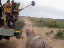 Sennheiser microphones capture every detail in the heart of the Kenyan wilderness
 Genelec monitors and Audio-Technica microphones allow Mediapro to capture every last sonic detail in your 4K production
 ABonAir AB405: un enlace microondas inalámbrico low-cost con alcance hasta 750 metros
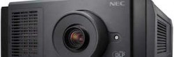 NEC launches its first compact RB laser cinema projector for screens up to 17 meters
 A total of 41 cameras, 9 of them in 4K, capture every last detail of the Barça-Madrid 'Clásico'
 Christie CP2208: a projector with xenon lighting for screens up to 10.6 meters
 Christie CP2215, superior brightness for projection on screens up to 15 meters
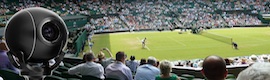 Los sistemas mini-robóticos de Camera Corps captarán hasta el mínimo detalle en Wimbledon
 New Apphulkcampro professional sports camera, waterproof up to 20 meters
 Intelliconnect IP68 Waterproof: conectores sumergibles hasta 10 metros
 Matrox Avio Series: KVM extension over fiber optics up to 1,000 meters
 HDBaseT, el sucesor del HDMI con hasta 100 metros de transmisión
 Keyboard, video and mouse extension up to ninety meters
 Panasonic Studio System: full remote control over distances up to one hundred meters